The distance was 4180 miles (about 67 hours) from Atlanta according to the shortest-distance calculated by GoogleMaps. My caravan-buddy said that we traveled about 13,000 miles for the whole trip.
This webpage 2 of 4 for my trip to AKFairbanks with my caravan-buddy, Ken. It is hard for me to decide which pictures to post and I can only post a few to each page because the load-time for the page would be too long if I didn't either make small pages or post fewer pictures. I have a tendency to want to share too much. This website was started before Google Maps became available on the internet with pictures. I decided to continue my blog because I wanted a way to share the pictures of my trip.
Just some scenery on the road. There were many outstanding picturesque views and it is hard to find the best to post.
2024-06-12_YTFtNelson,Scenery-while-driving
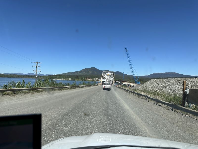
There is always road construction during the summer. We had many delays because of the work on the road, but - the delay usually wasn't long.
2024-06-12_YTTeslin-BridgeConstruction
-------------------------------------------------------------------------------------------------
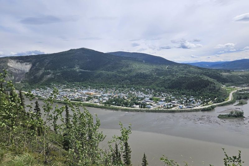
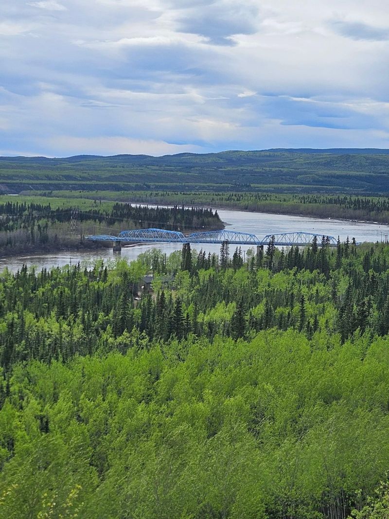
We were driving down a mountain area and I saw the bridge that we would probably cross. I stopped and took a picture that I felt was very scenic.
2024-06-12_YTWhitehorse,Scenery-while-driving
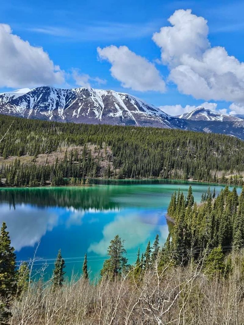
The colors of the water in the lake caught my eye in the second picture.
2024-06-12_YTWhitehorse,Scenery-while-driving
-------------------------------------------------------------------------------------------------
When we stopped at Dawson City visitors center, Ken said that he wished that he could drive to Inuvik. We had briefly discussed going there previous to starting the trip and I told him it was 'too far' for me. He still wanted to see it, so - I told him that I would wait in Dawson City for him to return.
We had many roadside stops for pit-toilets. I found some interesting writing on the walls and trash collection bins that I decided to not include. I guess if you want to see the writings, you need to drive to Fairbanks yourself!
2024-06-13_BCDawsonCity4-DowntownHotel
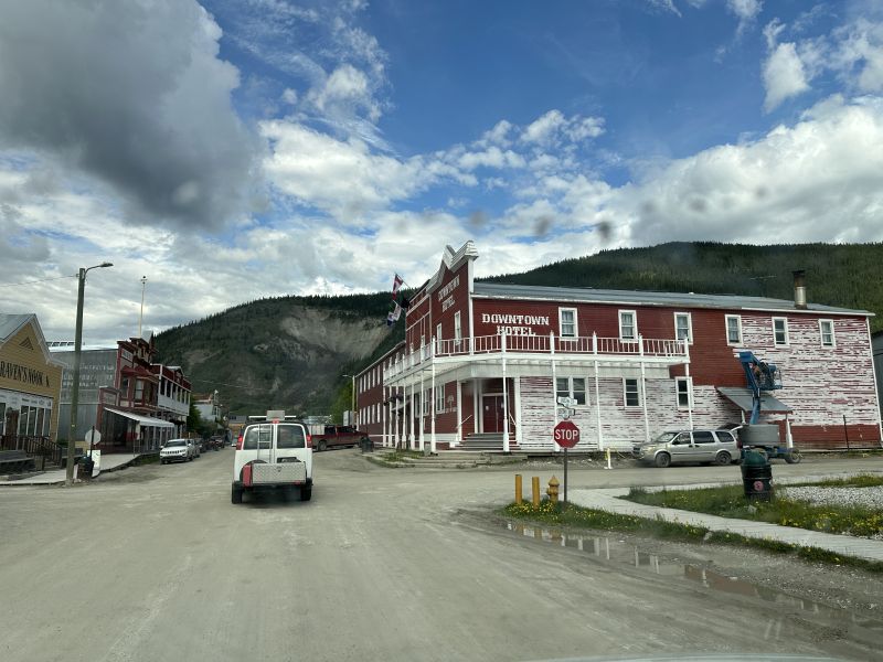
Notice that the Downtown Hotel is still being painted. There is a stand-on-bucket on the side and I saw people painting the doorway while I parked near it one day.
2024-06-13_BCDawsonCity-Keno-Paddlewheel-tour
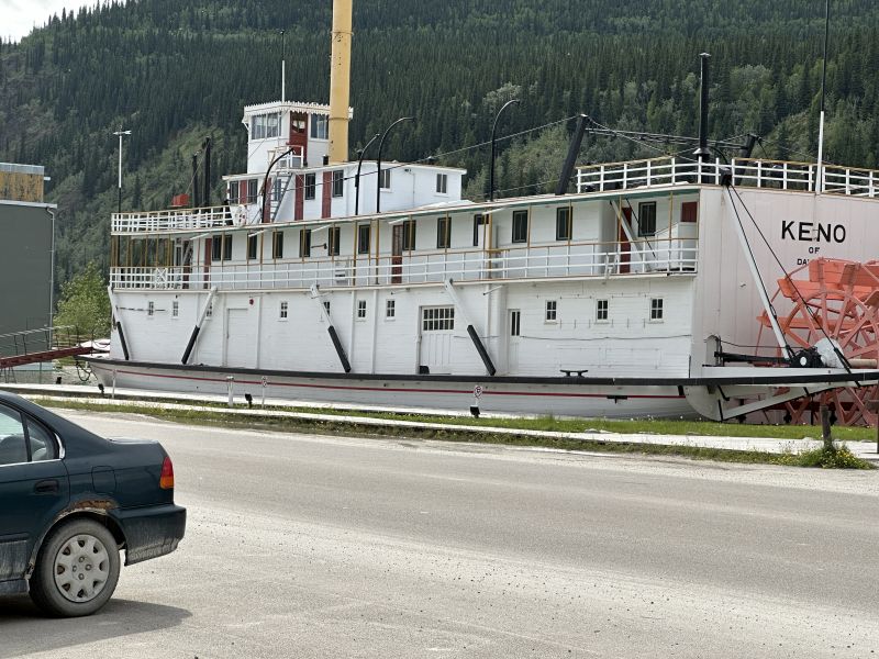
The 'Keno' paddlewheel was across from the visitors center and parallel to the river. I didn't take a tour of it but I think that one was available. The road between the Keno paddlewheel and visitors center was paved to the ferry. All the other roads were gravel. I think that someone told me that they scrape the town gravel roads in the spring.
2024-06-13_BCDawsonCity-VisitorsCenter
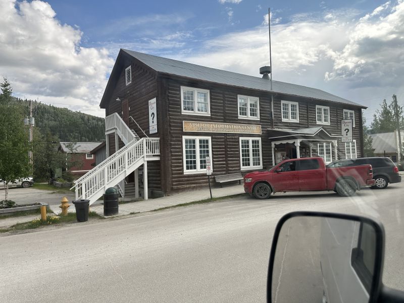
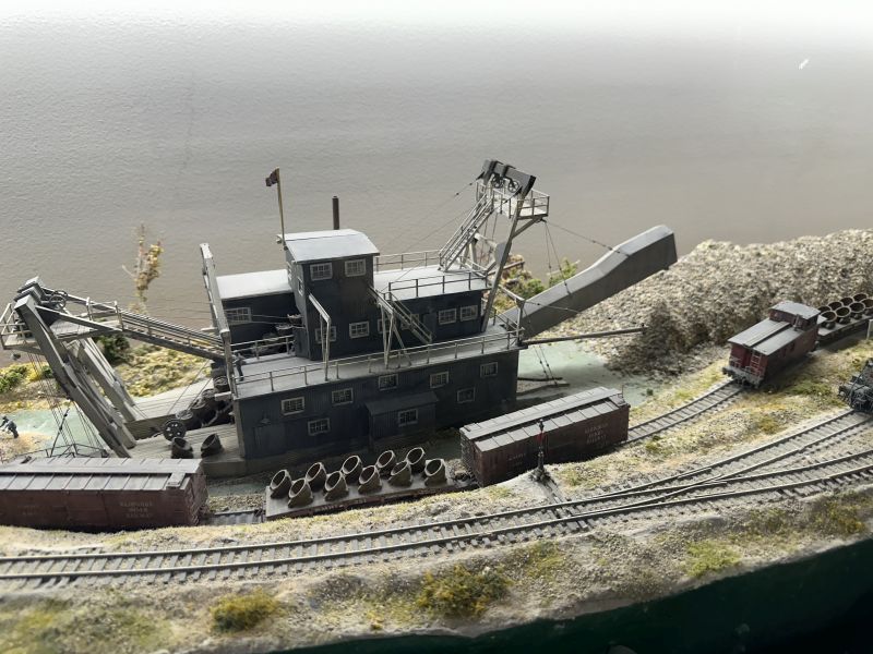
The gold-dredge model picture was taken in the visitors center. I spent a lot of time there because they had movies of the history of the area. I enjoyed the movies so much, I watched them more than once. Before environmentalists became active, gold-dredging was popular. Gold dredging was a thing during the gold-rush era - about 37 of them were built and used in many parts of Canada and Alaska. They would have buckets that dug-up the bottom of a creek and the dirt would be sifted inside the machine. The large rocks would be deposited by the conveyor-belt-arm which would swing from side-to-side. The gold was heavier than regular rock and would fall to the bottom of the sifter. Seeing the machine work on the film was interesting. Everything is available (so it seems) on youtube and I found a video there. I didn't go on a Gold Dredge tour but one was available.
2024-06-13_BCDawsonCity-VisitorsCenter-Dredge
-------------------------------------------------------------------------------------------------
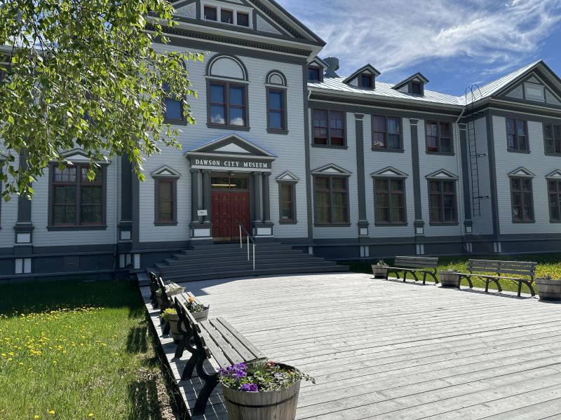
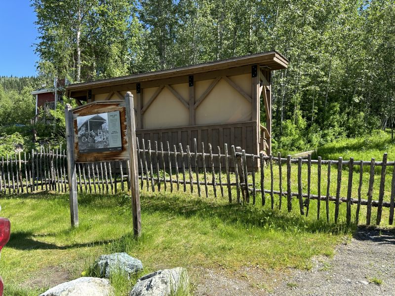
I really enjoyed the museum. I spent the majority of the day there. Nicholas gave several of us a tour of the 10 most-interesting artifacts. He told stories about each and why they are so unusual. Notice that there is a wooden boardwalk going to the door. The city uses boardwalks in many areas.
2024-06-14_BCDawsonCity-Museum
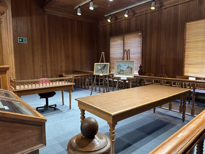
The top floor is a court house and I enjoyed seeing all the fine woodwork and art displayed there.
2024-06-14_BCDawsonCity-Museum
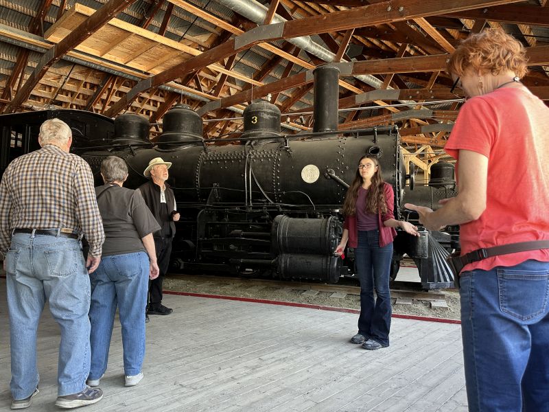
There is a locomotive-train building next door and after the inside tour finished, I waited a few minutes and the outside building train tour began. More people were there for the train building. In the history of the area, trains played a very significant part. Both tours were great. (By the way, the train building is locked and you need to take the tour to get inside.)
2024-06-14_BCDawsonCity-Museum
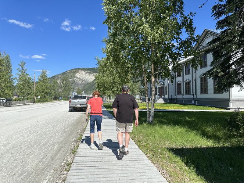
I just wanted to show the mountains in the background in this picture. The wooden sidewalk is seen as well as the gravel 'non-main' road.The town has a lot of people who walk and ride bicycles. By the way, the area is known as the 'land of the midnight sun' - it stays twilight most of the night. There are no streetlights because they don't need them. (I presume that it is SO COLD during the winter, no one walks at night.)
2024-06-14_BCDawsonCity-Museum
-------------------------------------------------------------------------------------------------
I had heard that you could drive to the top of Dome Mountain at the visitors center. I asked if it was 'steep' to drive and she answered 'yes'. I didn't want to drive on a road that was steep and happened to find that a company was nearby that offered a tour. I found the office, paid for a ticket and enjoyed the trip. The driver showed us the town cemetery on the trip back to the office. We didn't stop and around a corner, we were inside the town limit. As the driver drove the short-tour-bus to the office, he stopped at the corner of a business called Diamond-Tooth-Gerties and asked if anyone wanted to get-out. I heard someone in the back of the bus (with a tour group) say that they went last-night. I had seen in a local book advertisement about a show there and it was Saturday and about show-time. I made an instant executive decision to get-off-the-bus and see the show.
2024-06-15_BCDawsonCity_Diamond-Tooth-Gerties_CanCan-Show-Casino
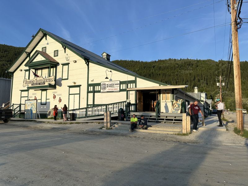
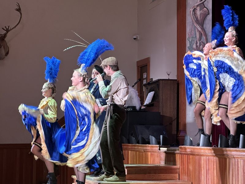
I had to pay $20-Canadian for an 'annual-pass' to get past the bouncer sitting on a stool near the door. Once inside, I saw the many card tables and casino machines. I was hungry and found the bar and ordered a hamburger. The first show was at 8pm and lasted 30 minutes. There were 2 singers = a woman and a man, and 4 can-can dancers. They presented a great high-energy show with a piano-player and drummer on the side. At the end of the show, an announcement was made that there was completely-different show at 10pm. I hung-around and saw the second show. The place was busy and I could tell that a lot of the people were locals because they seemed to know one another. They didn't announce other shows and it was late so I walked to my van after it.
2024-06-15_BCDawsonCity-DiamondToothGerties-showPerformers
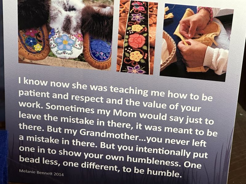
I continue to be fascinated about bead stringing and enjoyed a museum display about someone learning the art from their grandmother.
2024-06-15_BCDawsonCity-Museum_BeadDisplay1
-------------------------------------------------------------------------------------------------
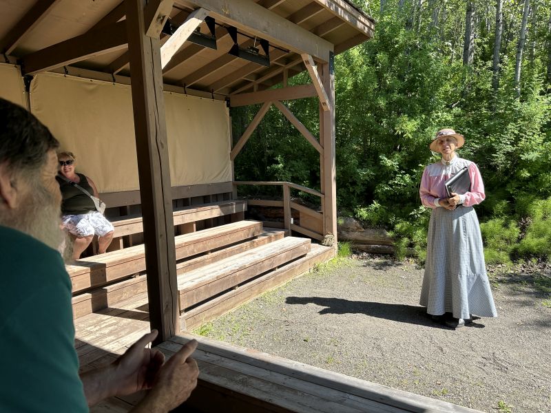
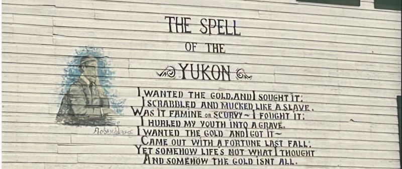
When driving through Calgary, I saw a major road named "Robert Service Rd". I had not heard that name before and it stuck with me that the last-name, Service, was unusual. After talking with employees of the visitors center, they said that there were cabins and tours in Dawson City for both Jack London and Robert Service. He wrote several books of poems and rented a cabin in Dawson City when he lived there. The owner of the cabin realized that he was both well-known and popular, so, the story is - that she preserved the cabin where he lived. I enjoyed the tour. A Robert Service poem.
2024-06-15_BCDawsonCity-Service,Robert(Poem_Spell-of-the-Yukon)
.jpg)
The cabin is up the hill, on the right is a booth where the tour begins and you pay. I made a mistake of using Google Maps to guide me to the tour location. My mistake was that I forgot to change the mode of transportation from car to walking. It took me longer to walk there than I had planned. (Notice that there are heaters in the top of the ampitheater.)
2024-06-15_BCDawsonCity-Service,Robert_CabinTour
Sign for the cabin and back of the ampitheater. The ampitheater is used to listen to his writings and begin the tour.
2024-06-15_BCDawsonCity-Service,Robert_CabinTour
Ampitheater and tour guide talking about Robert Service and his life and poems.
2024-06-15_BCDawsonCity-Service,Robert_CabinTour
-------------------------------------------------------------------------------------------------
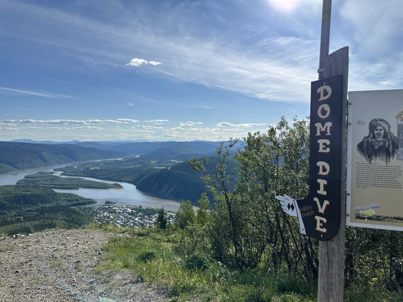
I didn't want to drive to the top of the mountain overlooking the city because I thought that the road may be too steep for my van. So, I found a tour company where a small-bus is used. The first picture overlooks Dawson City.
2024-06-15_BCDawsonCity-The-Midnight-Dome
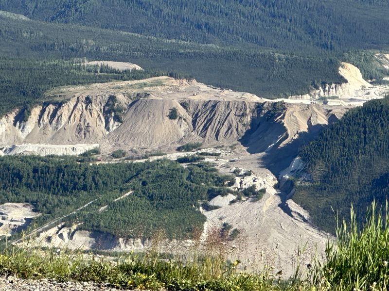
The second picture shows a mine that is visible from the top.
2024-06-15_BCDawsonCity-The-Midnight-Dome
-------------------------------------------------------------------------------------------------
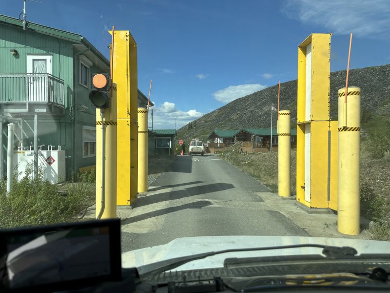
I had read in webposts and the Milepost book about the Dawson City ferry. I wondered why they didn't build a bridge across the river and asked at the visitors center. I was told that the area is impassable in the winter and, if a bridge was built, it would only be used one-half of the year. The tour-guide driving the bus to the top of the dome said that he lived in West Dawson, i.e., across the river. He said that they were able to drive cars across the winter ice and that there are problems associated with driving over the ice. The problem is that no-one is sure when the ice is strong enough to hold a car without trying to cross the river driving on the ice.
One place has a 'spring ice thaw' betting contest. They said that they placed a tripod on the ice. (I haven't seen it and thought that they used 3 logs tied at the top.) The betting is for what date/time the ice melts enough for the tripod to fall. The winner, of course, gets the money from the contest.
2024-06-17_YTDawsonCity_Ferry
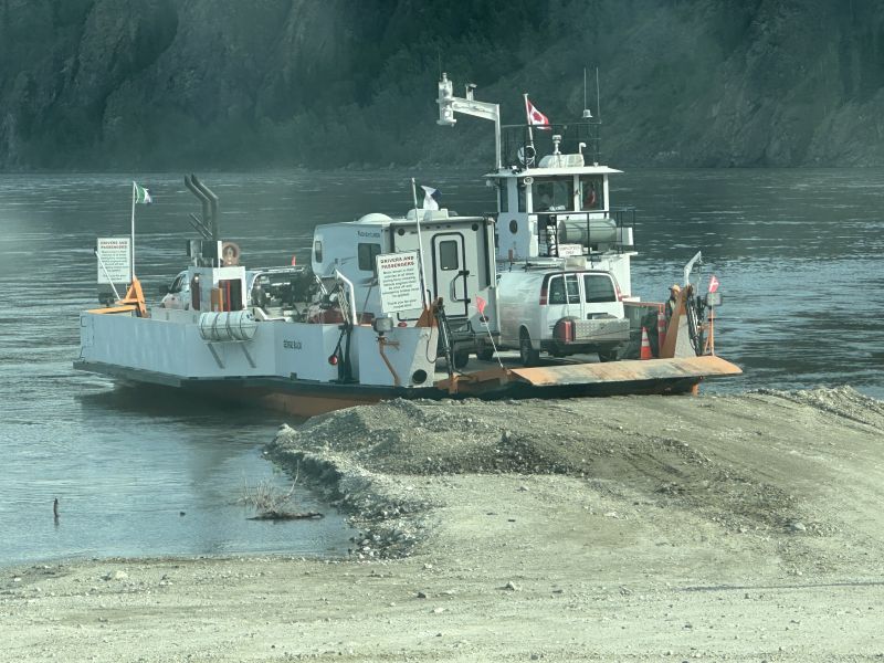
The ferry had signs to not get out your vehicle. My van was the first one on the right column and the ferry employee was in front preparing the ferry to depart the landing. I opened my door and used the camera to take a picture of the vehicles on the platform. The employee saw me open my door and was ready to come tell me to not get out when she saw me with the camera take the picture and close the door. She was relieved that I didn't get out and she would have to come scold me.
2024-06-17_YTDawsonCity_Ferry
-------------------------------------------------------------------------------------------------
Many of the Dawson City buildings were freshly painted. Also, many of the buildings were old and needed attention - and, I think that they were unoccupied. Nevertheless, I found a building with a poem painted on the side. The poem was written by Robert Service and the same poem was in the visitors center posted on a wall. I took a picture of both and posted both of them on this webpage. After crossing the river on the ferry, we drove past West Dawson and non-paved (i.e., gravel) road was called 'top of the world' highway. It was beautiful and the mountains were not 'high' like Glacier National Park, but - you felt like you could see long-distances.
2024-06-17_YTDawsonCity_The-Spell-of-the-Yukon1-painted on the side of a building
2024-06-17_YTDawsonCity-West_Top-of-the-world-highway
2024-06-17_YTDawsonCity-West_Top-of-the-world-highway-at-border
-------------------------------------------------------------------------------------------------
Pit stop = I posted another picture of a vault toilet. At least we didn't have to stop and go into the woods - that wouldn't be a 'good thing'.
2024-06-17_BCCarmacksLanding_VaultToilet

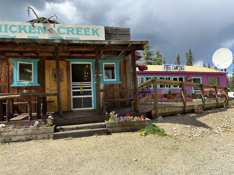
There is a town called 'Chicken' or 'Chicken Creek'. It is not large and there is a 'mall' of about 4 business fronts, I don't remember seeing any houses and presume that the residents lived in the woods nearby. My book describes it has having a population of 23 in the summer and 7 in the winter. It has no city water, sewer, electric service or cell service. The state bird of AK is ptarmigan. The residents wanted to name the town ptarmigan but no one could spell it, so they chose to name the area 'Chicken'. I didn't post a picture of their 'outbuilding' since I have posted others.
2024-06-17_BCChickenCreek_Top-of-the-World-Road
We drove across the street and there was a trading post. There was also a gold-dredge on display and an art, metal chicken sculpture at the top of a hill.
2024-06-17_BCChickenCreek_Top-of-the-World-Road
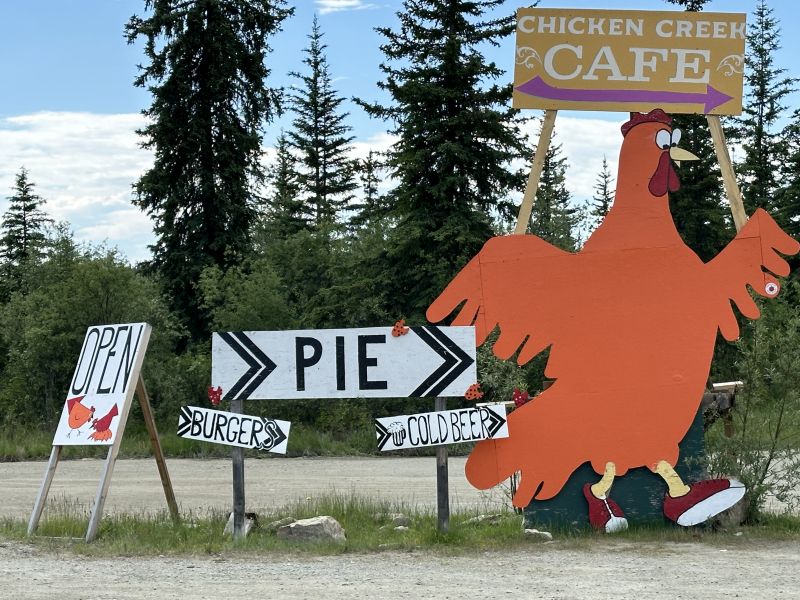
Signs to direct tourists to the 'mall'.
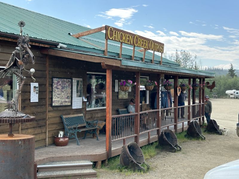
2024-06-17_BCChickenCreekOutpost_Top-of-the-World-Road-notice the buckets on the ground are from a gold-dredge
Spruce trees in the area are struggling to recover from a fire.
2024-06-17_BCPellyCrossing_Notice-forest-fire-trees

-------------------------------------------------------------------------------------------------
As always, any comments that you have about the website would be appreciated. Because the pictures take a long time to load, it is best to view these webpages using a desktop.
Blog-Note 1: http://PuddinInVannaWhite.wordpress.com is the 'original' website of this blog. This blog has a domain name without the .wordpress. middle name. see website=PuddinInVannaWhite.wordpress.com for older trips ---)))LEFT MOUSE CLICK HERE"(((---
Blog-Note 2: I have another website. It is about my 1971 MGB. I sold it but still retain great memories from the days that I owned it. The url address is : see website=PuddinInThe MGB.wordpress.com ---)))LEFT MOUSE CLICK HERE"(((--- )
Blog-Note 3: http://PuddinInParis.wordpress.com is the first blog that I created. see it for the first trip after I retired ---)))LEFT MOUSE CLICK HERE"(((---