The distance was 4180 miles (about 67 hours) from Atlanta according to the shortest-distance calculated by GoogleMaps. My caravan-buddy said that we traveled about 13,000 miles for the whole trip. At the end of this post is 7 weblinks to google-maps of the roads we drove.
This webpage 4 of 4 for my trip to AKFairbanks with my caravan-buddy, Ken.
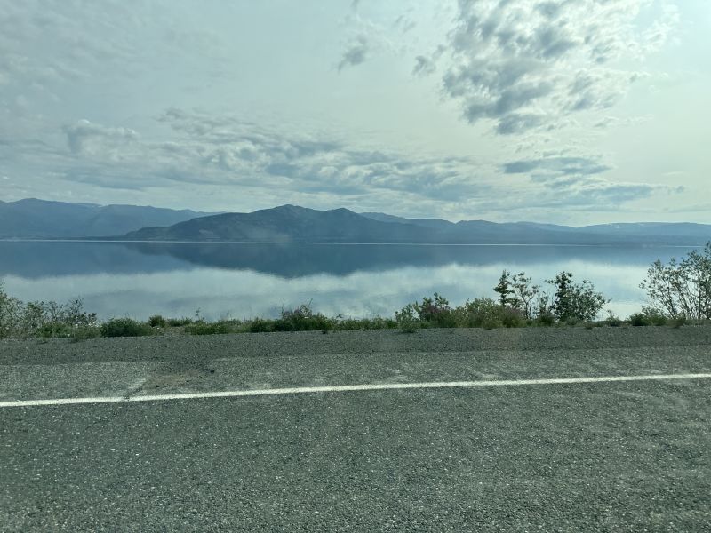
This picture doesn't show as well on the web as I would like. There is a smooth glass-top lake with reflecting clouds above.
2024-06-26_YTCascadia - glass-top lake
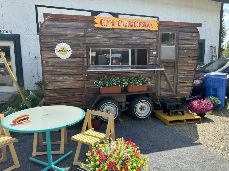
Courtney Caribou Cookshack - had only been open a couple of days when I stopped for a hot dog. Courtney was young and enthusiastic about her business.
2024-06-27_YTWatsonLake-Courtney-Caribou-Cookshack
-------------------------------------------------------------------------------------------------
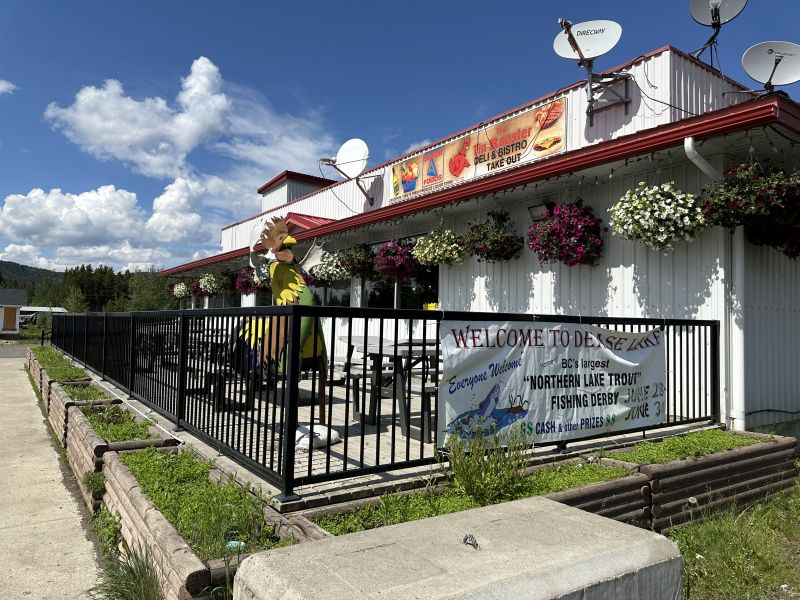
Dease Lake Store - at the turn for the Cassier Highway. The rule was to stop and get gas if the tank is near one-half empty. The gas stations are really far apart in some sections of Canada. We not only got gas here, but we purchased and ate submarine sandiches (premade).
BCCassierHwy_DeaseLakeStore
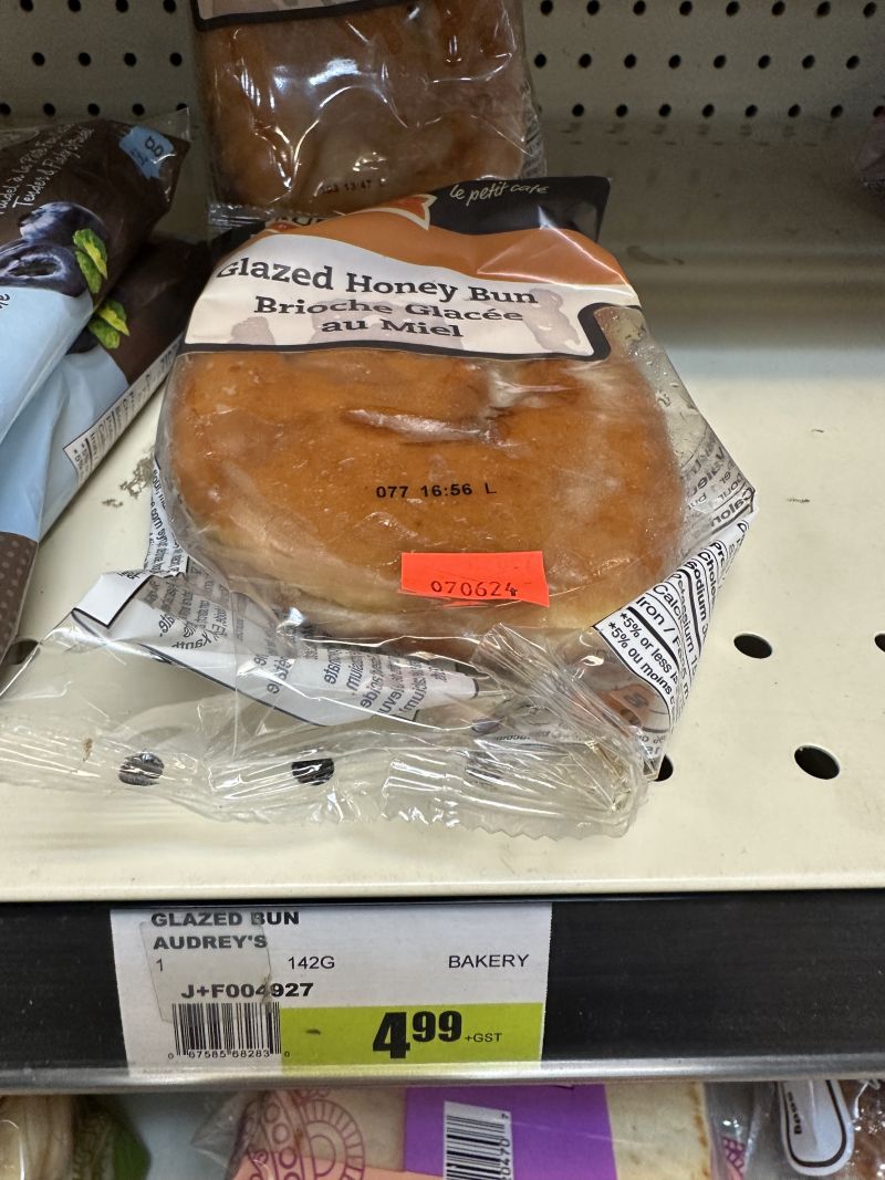
In remote areas, you have to pay more for food and goods. I took this picture to give the reader an idea of expenses. If you compare to prices in Atlanta, you have to remember to convert Canadian dollars to American value.
2024-06-28_BCCassierHwy_DeaseLakeStore-HoneyBun499
-------------------------------------------------------------------------------------------------
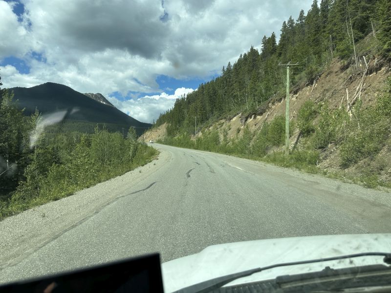
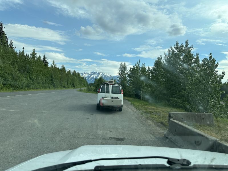
The Stewart-Cassier highway is the route to Hyder, Alaska. The road was paved all the way through Hyder to the National Park. After a few miles, it changed to gravel to get to the Salmon Glacier.
View of mountains on the highway road.
2024-06-28_BCCassier-Hwy_View
You never know what you will find on the highway. In this remote area, I was happy that they had vault toilets.
2024-06-28_BCCassier-Hwy_Vault-Toilet
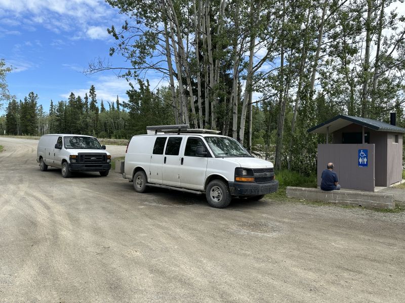
We drove until we were tired. We had a look at the map of the next rest area and decided that the weather was good, the road was fair and I thought that I had enough energy to drive more. This is where we stopped. There was a gravel air-landing-strip on the right of the parked van. On the morning when we left, a corporate jet took off. I presumed that they used the airport with the mining operations in the area. Notice dirty windshield.
2024-06-28_BCStewart_BobQuinnRestStop
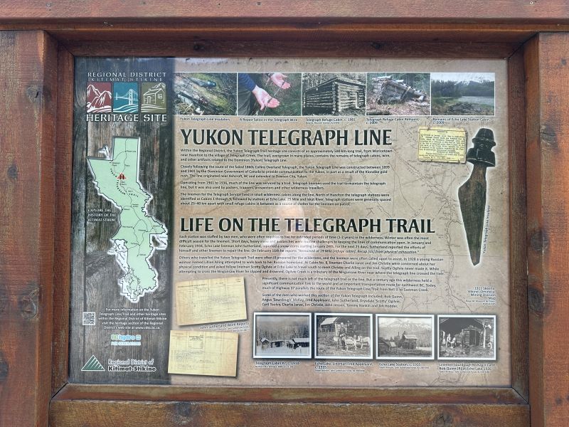
There was a roadside storyboard about the use of telegraph in the area. It was very interesting.
2024-06-28_BCStewart_BobQuinnRestStop-Storyboard_YukonTelegraph
-------------------------------------------------------------------------------------------------
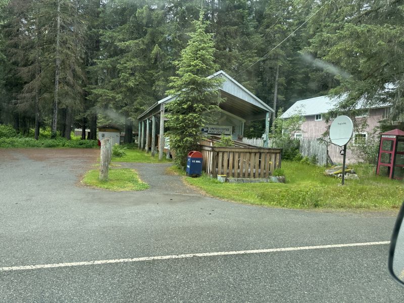
From the Milepost book that I have, Stewart has 100 people living there and Hyder has 100. They are 2.3 miles from each other. Actually, you drive through Stewart, cross a small bridge over a creek, and you are in Hyder. The thing is ... Stewart is in British Columbia and Hyder is in Alaska, i.e., USA.
2024-06-29_AKHyder11.-PostOffice
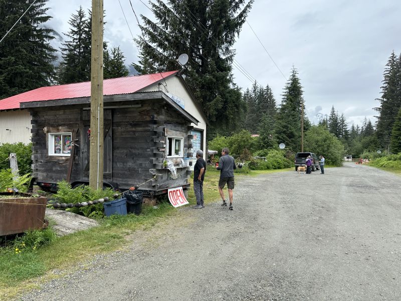
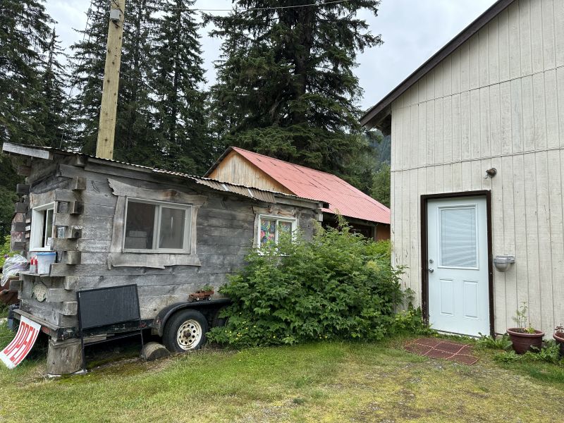
We decided to take the advice of Santa and go to Hyder. This food truck was recommended by the lady who owned the gift shop. It is called Fish and Chips to go. You may eat on the picnic tables. We were told that eating lunch at the boat ramp would be nice. Chips is the description of french fries. (I think of chips as food in a bag like potato chips.)
2024-06-29_AKHyder21-FoodTruck_Fish-and-Chips to go
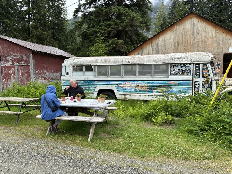
The picnic-tables were on the left of where you place your order at the window. A fish sales building was on the right.
2024-06-29_AKHyder23-foodTruck-picnicTables
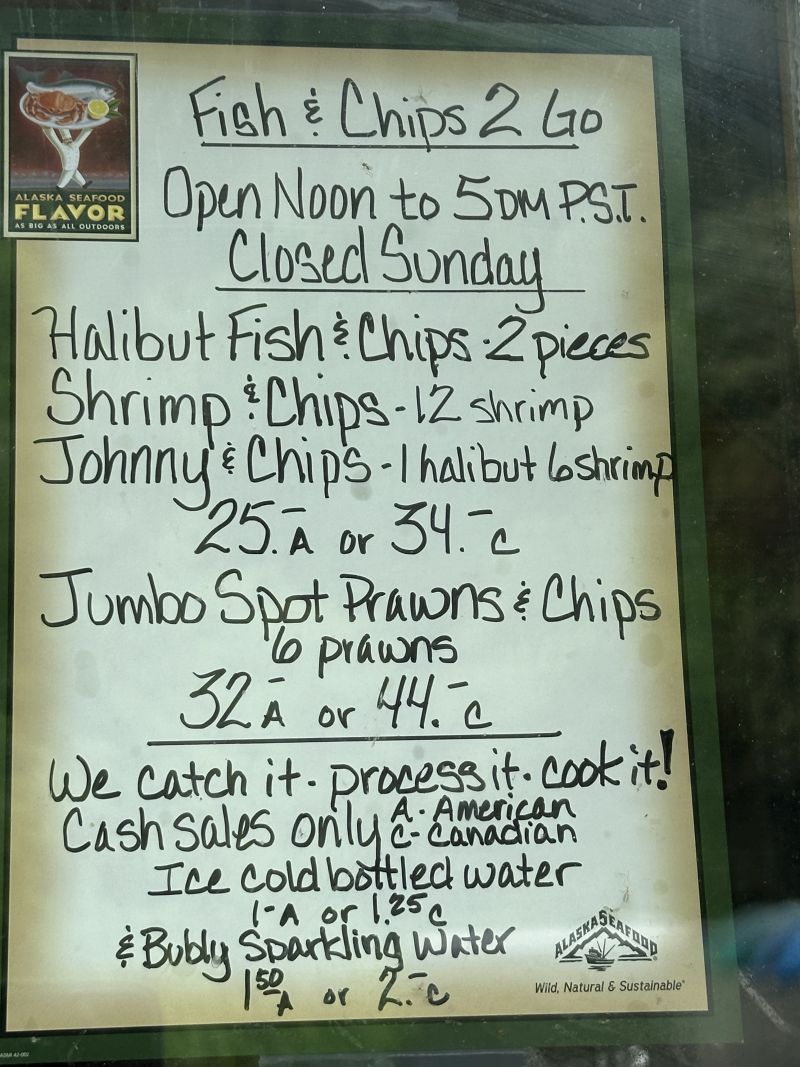
The owner, Diane, had a menu-board for selection of your meal.
2024-06-29_AKHyder24-foodTruck-menu
The fish sales business was on the right of the food-truck.
2024-06-29_AKHyder27-foodTruck-Fish-Sales-Next-Door
This is a picture of the meal that I ate from the food truck.
2024-06-29_AKHyder29-foodTruck-Shrimp-and-Halibut
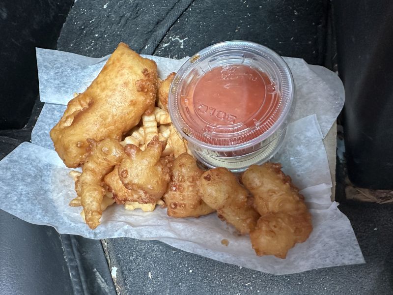
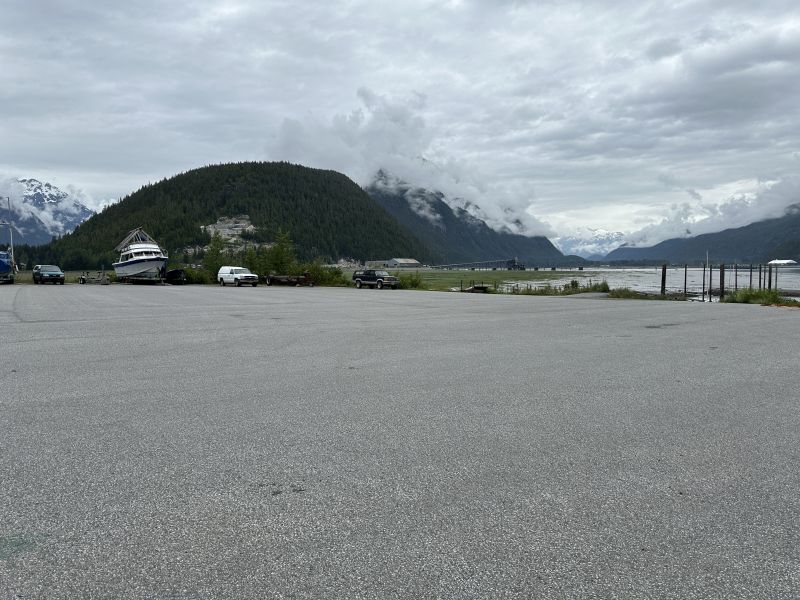
The food was too hot to eat because it had just been fried. While it cooled, we drove to the boat ramp. The weather was cool and breezy and I ate sitting in the van. I was amazed at the scenery of the mountains and Pacific Ocean. Ken took his shoes off and took a picture of his feet in the Pacific Ocean. It is hard to see the boat ramp from this picture, but it is on the left of the tall poles. We were told that a cell signal was available here and both of us took advantage of the opportunity of checking messages. We had not had service available for several days.
2024-06-29_AKHyder30-boatramp2
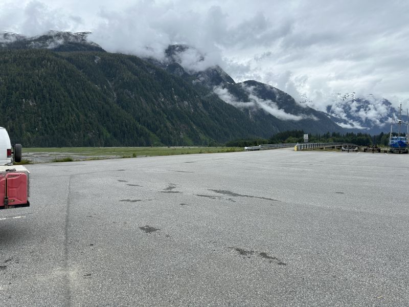
The bridge to the mainland is visible in the middle of the picture. The area around this side was mud and we were told to not consider walking around there. The drive to the boat ramp was about three-tenths of a mile from the main-road.
2024-06-29_AKHyder30-boatramp3
-------------------------------------------------------------------------------------------------
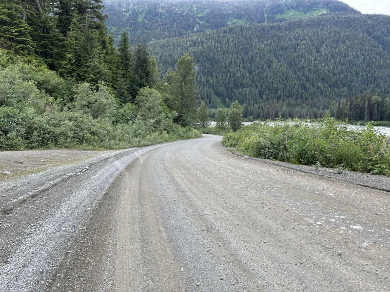
We asked the gift shop saleswoman for a nearby place to park overnight. She told us about the gravel road which was the continuation of the paved road. We drove about 5 miles down it and parked in a gravel area which was partially cleared. The river is on the right and there are rock-shelves before reaching the flowing-river-current.
2024-06-29_AKHyder33_NationalForest_GravelRoad_
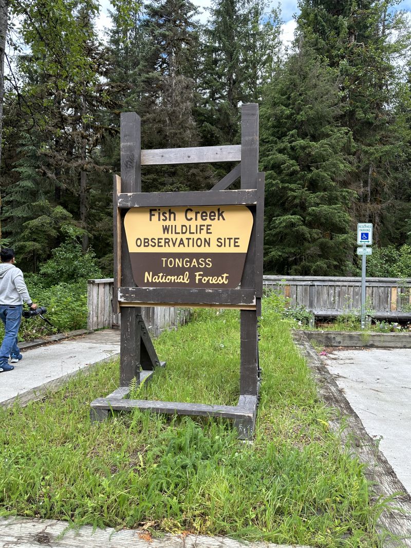
We saw the observation area when we were looking for overnight parking. We stopped to see more of the area on the next morning when we left.
2024-06-29_AKHyder42_NationalForest_Sign-FishCreekWildlifeObservation
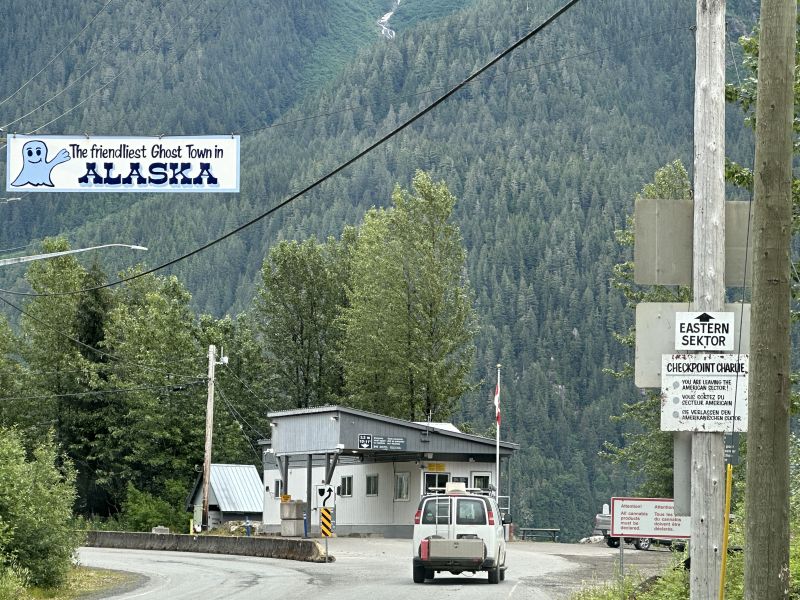
We were told about border control by the gift shop saleswoman and we had to be cleared to return to Canada. Hyder calls itself the friendliest ghost town in Alaska and put a banner over the highway for everyone to see.
2024-06-30_AKHyder44_Border-Crossing
-------------------------------------------------------------------------------------------------
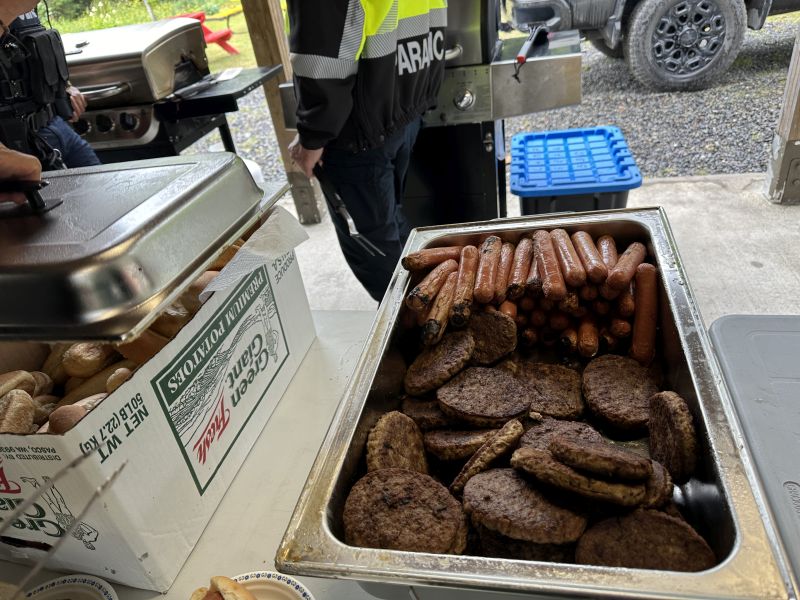
After clearing border control, we went to the Stewart visitors center. We saw a firemen's benefit hamburger and hot dog cook out that was part of Canaday Day celebration nearby. It wasn't crowded and we were hungry for lunch, so we joined in.
2024-06-30_AKStewart,Hamburger-HotDogs_FiremenBenefit
This sign was at the intersection of the road to Stewart/Hyder and the Cassier. We had diverted about 35 miles one-way in order to visit Stewart/Hyder.
2024-07-01_AKGitwangak_(Sign)North-to-AK
North-to-AK.jpg)
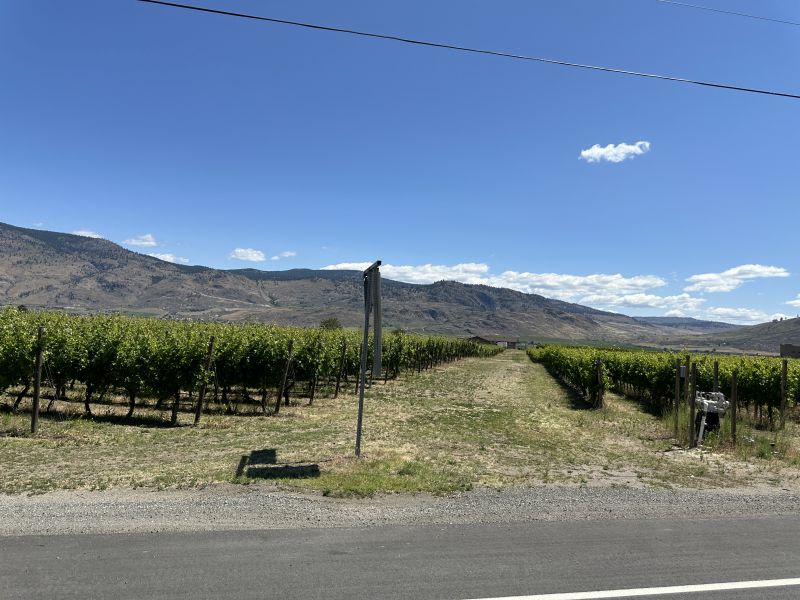
As we drove to border checkpoint Osoyoos, we saw many farms. I was amazed to see the miles and miles of cultivation.
2024-07-03_BCOsoyoos_farm1
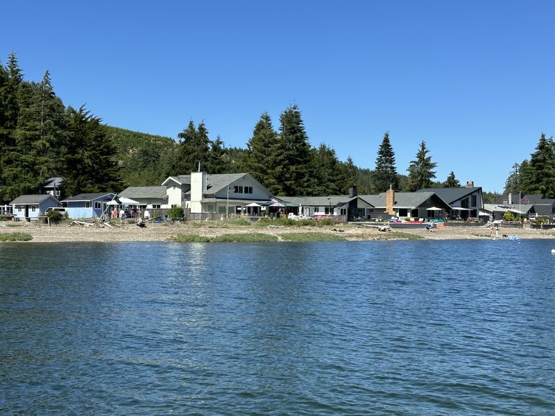
I have friends who live south of Seattle. They invited Ken and me to visit. We were on an adventure and decided to take my friends up on their offer. I was amazed at the area - it was absolutely beautiful. By the way, my friends are only there for the summer. They winter in Florida. I visited them last January and posted pictures of the visit on my blog.
2024-07-04_WATahuya_(Map)Hood-Canal
Hood-Canal.jpg)
My friends showed us their playground and dock area. It was very nice and the weather was perfect. It was the 4th of July week-end and the area was busy. My friend said that Bill Gates has a house across the lake somewhere.
2024-07-04_2024-07-04_WATahuya-HomeownerAssoc-View_From-Dock-End
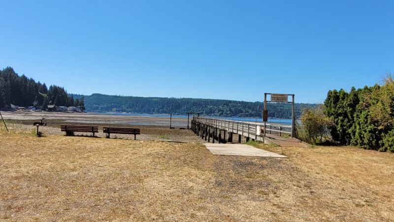
Another view near the boat dock
2024-07-06_WATahuya,HomeownerAssocBoatDock,Ramp,Swim_Area
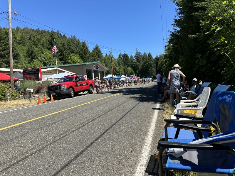
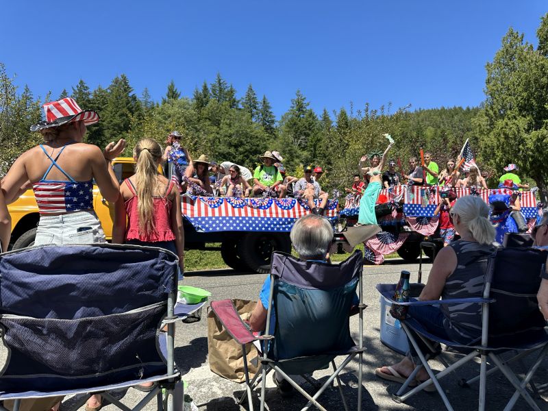
The town sponsored a 4th of July parade on Saturday. Residents placed chairs along the side of the highway the day before the parade so that they could have a front-seat-view. We were more interested in sitting in the shade.
2024-07-06_WATahuya-4thJulyParade1
Waterguns and hard candy.
2024-07-06_WATahuya-4thJulyParade8
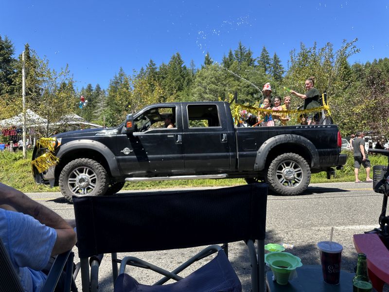
North Shore Landscaping. There was also a real semi-tractor-with-logs and a funeral business with an open-door hearsh. The parade was an opportunity for local businesses to advertise. No bands and not many floats.
2024-07-06_WATahuya-4thJulyParade13
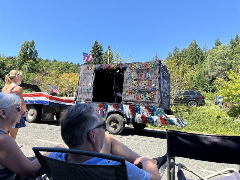
2024-07-06_WATahuya-4thJulyParade16
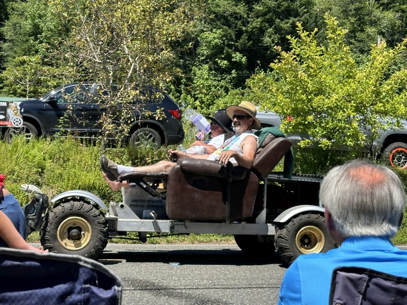
I called this the 'Couch Car'-but, the driver really had a lounge chair. He controlled driving with a stick in his right hand. I presume he had brakes there somewhere because he didn't have anything near his feet.
2024-07-06_WATahuya-4thJulyParade20-couchCar
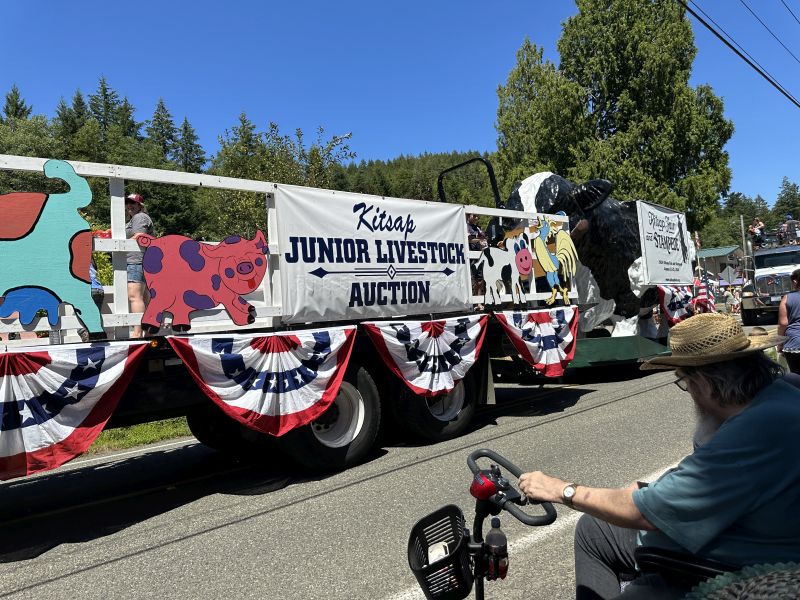
Junior livestock auction.
2024-07-06_WATahuya-4thJulyParade24
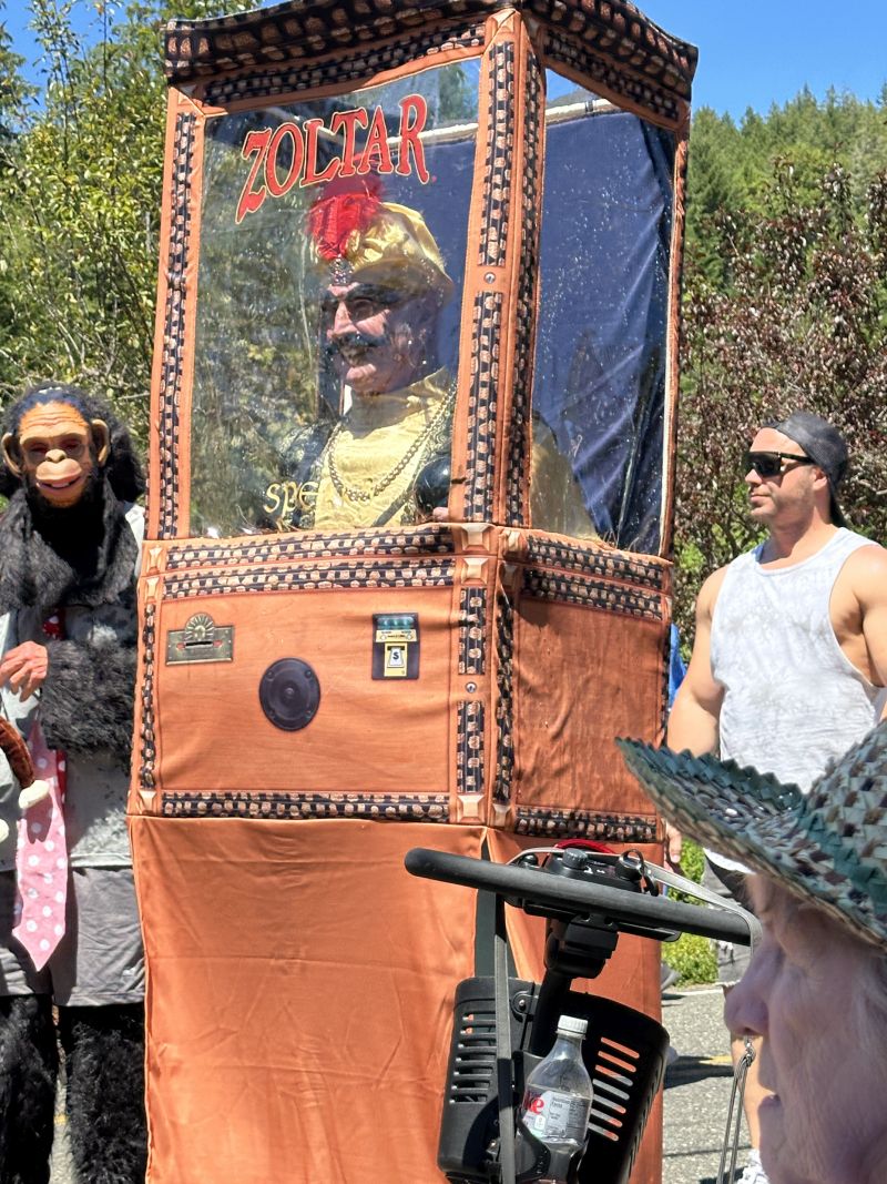
Zoltar and a man dressed as a monkey, plus other characters were in the parade walking on the side.
2024-07-06_WATahuya-4thJulyParade30-Zoltar
When we left Seattle, we were on the interstate and stopped for a break. It's the first time that I've seen banks of porta-potties. I presumed we were in an area without running water.
2024-07-08_WA_RestStop_Porta-potties(Area-lacks-water)
.jpg)
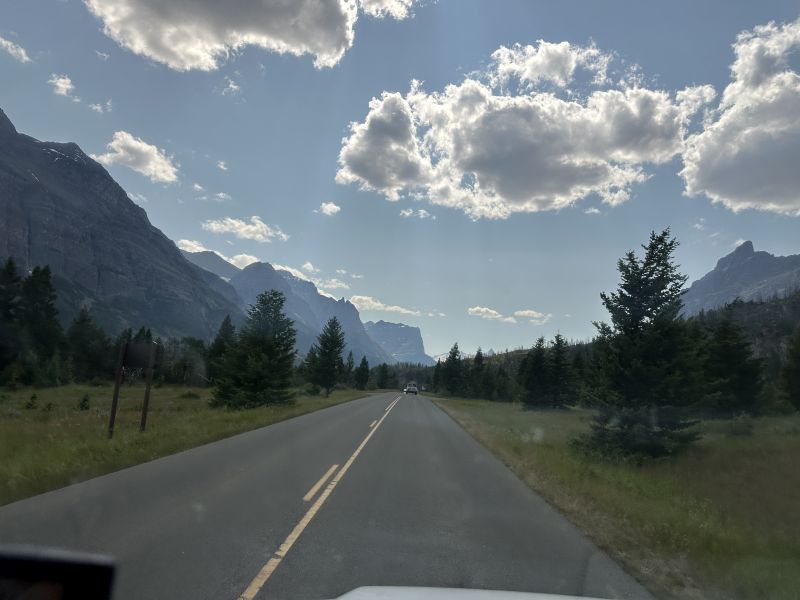
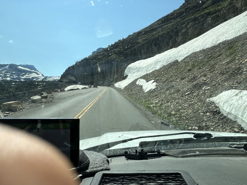
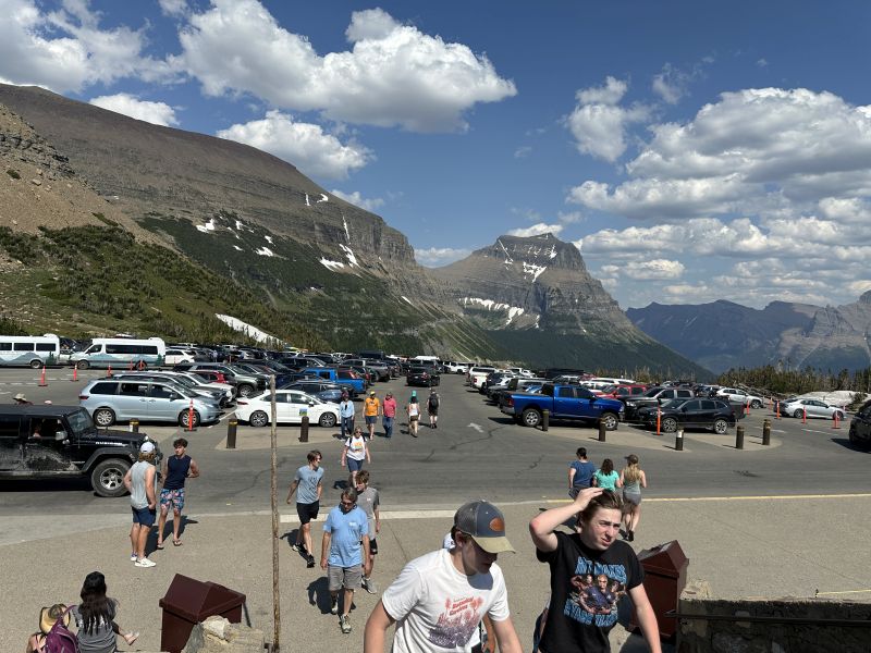
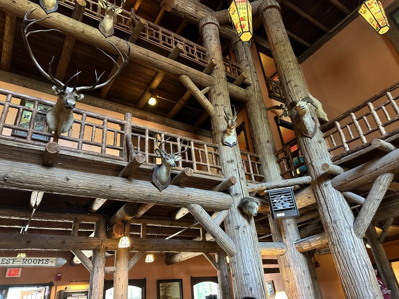
One of the highlights of the trip was to drive the "Going to the sun road" in Glacier National Park. It was absolutely beautiful and we had great weather. We also stopped at Lake McDonald hotel. It was built to attract tourists to the area after it became a national park. Many Americans would tour Switzerland, so they built the hotel to look like what they would see there.
2024-07-09_1551_MTBabb,GlacierNatlPark_GoingToSunRoad
2024-07-09_1615a_MTBabb,GlacierNatlPark_GoingToSunRoad
2024-07-09_1624_MTBabb,GlacierNatlPark_GoingToSunRoad_VisitorsCenter
2024-07-09_1702_MTBabb,GlacierNatlPark_GoingToSunRoad
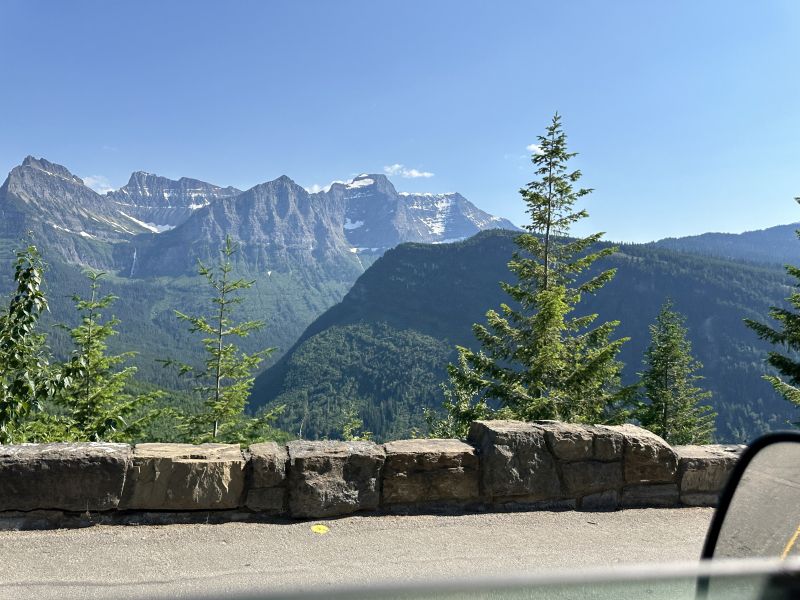
2024-07-09_1705_MTBabb,GlacierNatlPark_GoingToSunRoad
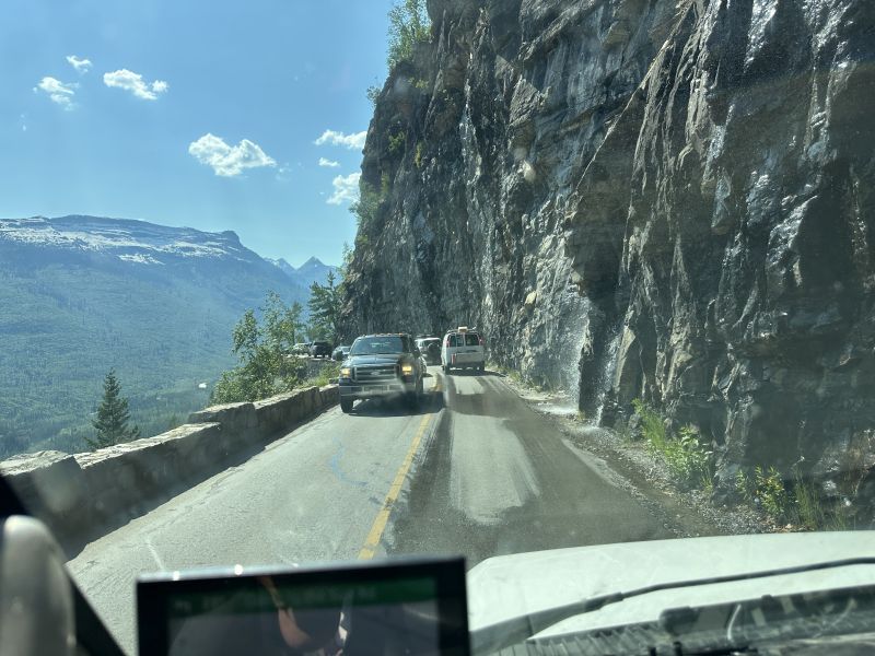
2024-07-09_1741_MTBabb,GlacierNatlPark_GoingToSunRoad_WestGlacier
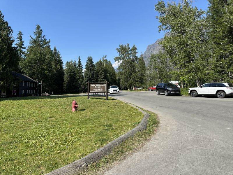
2024-07-09_1742_MTBabb,GlacierNatlPark_GoingToSunRoad_WestGlacier_LakeMcDonaldLodge
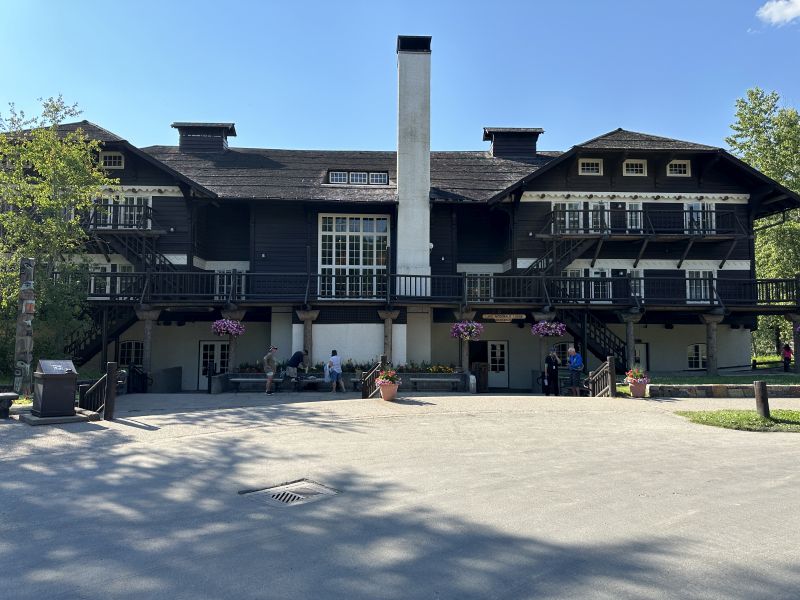
2024-07-09_1743_MTBabb,GlacierNatlPark_GoingToSunRoad_WestGlacier_LakeMcDonaldLodge
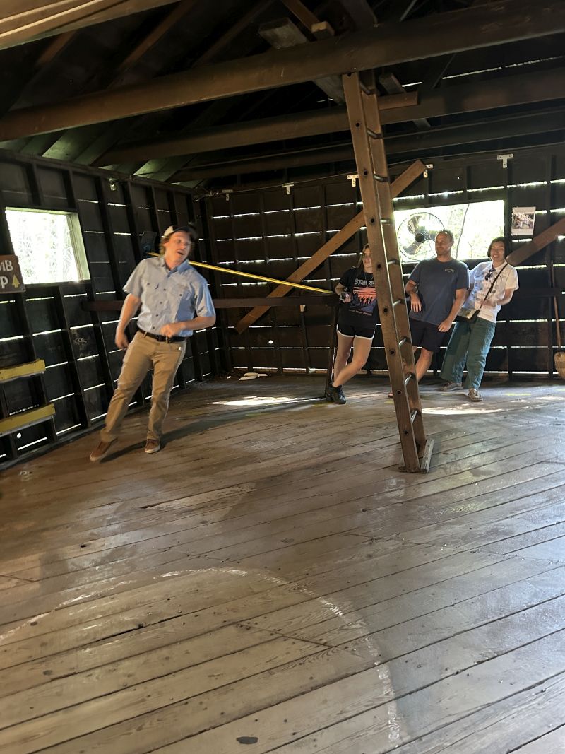
After our drive through Glacier National Park, we spent the night in Columbia Falls. The next morning, we visited the roadside attraction called "Montana Vortex". The tour guide explained that forces-of-gravity were unusual there and several other places in the US. I found it on the internet before the trip and wanted to stop and see it while we were in the area.
2024-07-10_1056_MTColumbiaFalls,MontanaVortex-House-where-gravity-is-strong
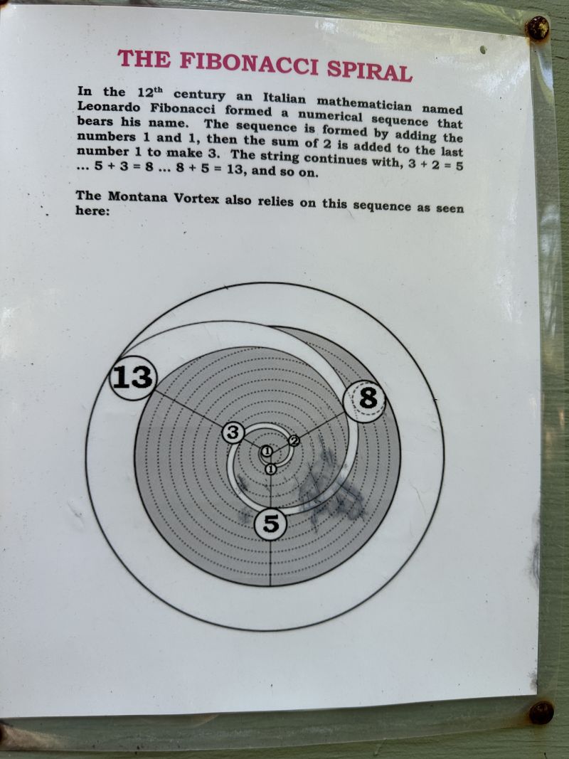
There was a map of the other vortex places in the US (4 of them) and a math explaination of a Fibonacci spiral.
2024-07-10_1107e_MTColumbiaFalls,Montana-Garden-display-board
We drove highway 2 across the top of the US. It is below the Canada border of the 44th parallel. A friend had told Ken to stop at the Blackfeet Indian Reservation Museum and we did.
2024-07-10_MTBlackfeet_Indian-Reservation_Museum(could not take pics inside)
.jpg)
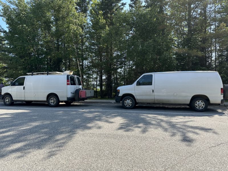
It was sad for such a great trip to come to an end. We only stopped at rest areas on the way home, and this picture was practically the last one taken. Highway 2 intersects with Interstate 75 in the upper penisula of Michigan. I couldn't take any pictures on the Macinac Bridge. Once we started driving south, the weather was substantially hotter. Notice how dirty "Vanna White" is. I washed the windshield every time we stopped for gas and there was a handle-rubber-tip cleaner available. Several times, there were so many dead bugs on it, I could hardly see out.
2024-07-14_MIMacinack_RestStop-2WhiteVans
Here are the 7 links to google maps that give details of the trip: (The route of our trip 'base' was found in the Milepost book. Near the end of the trip, we did return to Calgary, but did NOT drive the segment to Edmonston. I have friends near Seattle who had parking and invited us to visit - so we did! From there, we drove Highway 2, the road just below the Canadian border to I-75 and then south to Atlanta.)
---)))LEFT MOUSE CLICK HERE for 1st Segment of trip"(((---
---)))LEFT MOUSE CLICK HERE for 2nd Segment of trip"(((---
---)))LEFT MOUSE CLICK HERE for 3rd Segment of trip"(((---
---)))LEFT MOUSE CLICK HERE for 4th Segment of trip"(((---
---)))LEFT MOUSE CLICK HERE for 5th Segment of trip"(((---
---)))LEFT MOUSE CLICK HERE for 6th Segment of trip"(((---
---)))LEFT MOUSE CLICK HERE for 7th Segment of trip"(((---
-------------------------------------------------------------------------------------------------
End-of-trip analysis: I am glad that we made the trip. I have many good memories and pictures. BUT - I am glad to be home safe-and-secure. I feel blessed to have been on a trip of this magnitude and to have returned safely. If you would like to talk with me more about my experiences, please feel free to email or call.
-------------------------------------------------------------------------------------------------
As always, any comments that you have about the website would be appreciated. Because the pictures take a long time to load, it is best to view these webpages using a desktop.
Blog-Note 1: http://PuddinInVannaWhite.wordpress.com is the 'original' website of this blog. This blog has a domain name without the .wordpress. middle name. see website=PuddinInVannaWhite.wordpress.com for older trips ---)))LEFT MOUSE CLICK HERE"(((---
Blog-Note 2: I have another website. It is about my 1971 MGB. I sold it but still retain great memories from the days that I owned it. The url address is : see website=PuddinInThe MGB.wordpress.com ---)))LEFT MOUSE CLICK HERE"(((--- )
Blog-Note 3: http://PuddinInParis.wordpress.com is the first blog that I created. see it for the first trip after I retired ---)))LEFT MOUSE CLICK HERE"(((---